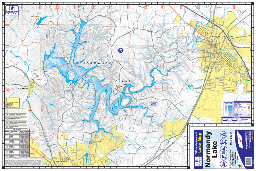
Normandy Lake Waterproof Map #1721
Price range: $13.99 through $34.99

Normandy Lake Waterproof Map #1721
Price range: $13.99 through $34.99
- Waterproof and Tear Resistant
- One-sided 24″x36″
- Folded to 6″x9″
- Scale 1:24,000
- 10ft Contour Intervals
- GPS Point Locations
The Kingfisher Maps Normandy Lake Waterproof Map #1721 includes detailed coverage of Normandy Lake located on the Duck River in Coffee County, Tennessee. This 24″ x 36″, one-sided, topographical lake map includes boat ramps, campgrounds, recreation areas, 10 foot contour intervals, and more. The map is printed on a durable, waterproof, tear-resistant paper and folds down to 6″ x 9″.
Additional information
| Weight | N/A |
|---|