Lake Norman Waterproof Map #341
$13.99 – $34.99


Lake Norman Waterproof Map #341
$13.99 – $34.99
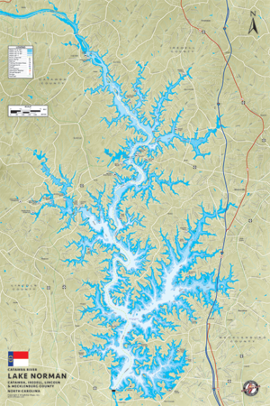
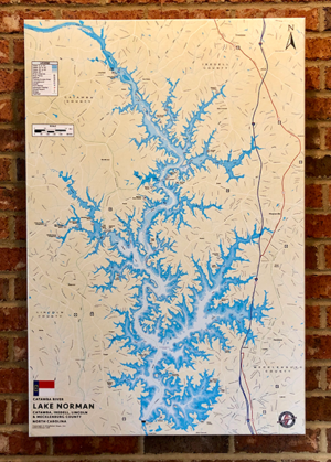
Lake Norman 25″x38″ One-sided. Scale 1:40,000 Waterproof and Tear Resistant!
Lake Norman 25″x38″ One-sided. Scale 1:40,000 Waterproof and Tear Resistant! GPS Compatible, Marina Listings, Lake Structure, Road Network and More. Lake Norman is the largest manmade lake in the state. When filled to capacity, its surface area is 32,510 acres with a shoreline of 520 miles and a main channel 34 miles in length. Thirteen miles of the shoreline are in the state park, which provides boating access. Stripers, bass, crappie and catfish can be caught all year on Norman and surrounding lakes.
Additional information
| Weight | 5 oz |
|---|