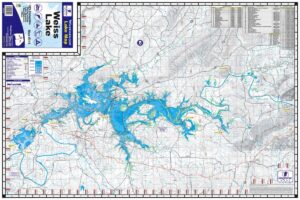
West Point Lake, on the Georgia and Alabama border 1:45,000 One-sided 25″x38″ Map. West Point Lake extends 35 miles along the Chattahoochee River on the Alabama-Georgia state line. The lake’s 500 miles of shoreline provides excellent opportunities for fishing, camping, boating and other recreational activities. Waterproof and Tear Resistant!
West Point Lake Waterproof Map #303
$13.99 – $34.99
West Point Lake Waterproof Map #303
$13.99 – $34.99
- Waterproof & Tear-Resistant Lake Map
- One-sided 25″x38″ Scale 1:45,000
- Lake Structure, GPS Points, Markers
- Marina and Facility Locations
SKU: 303
Categories: AL Lake Maps, GA Lake Maps, Maps
Additional information
Weight | N/A |
---|
You may also like…
-
Select options This product has multiple variants. The options may be chosen on the product page
Logan Martin Lake Waterproof Map #108
$13.99 – $34.99
-
Select options This product has multiple variants. The options may be chosen on the product page
Lake Allatoona Waterproof Map #202
$13.99 – $34.99
-
Select options This product has multiple variants. The options may be chosen on the product page
Lake Eufaula / Walter F George Reservoir Waterproof Map #308
$13.99 – $34.99
-
Select options This product has multiple variants. The options may be chosen on the product page
Weiss Lake Waterproof Map #315
$13.99 – $34.99
Related products
-
Select options This product has multiple variants. The options may be chosen on the product page
Guntersville Waterproof Map #102
$13.99 – $34.99
-
Select options This product has multiple variants. The options may be chosen on the product page
Lake Norman Waterproof Map #341
$13.99 – $34.99
-
Select options This product has multiple variants. The options may be chosen on the product page
Neely Henry Lake Waterproof Map #104
$13.99 – $34.99
-
Select options This product has multiple variants. The options may be chosen on the product page
St. Johns River NORTH Waterproof Map #332
$13.99 – $34.99