St. Johns River CENTRAL Waterproof Map #314
$13.99 – $34.99


St. Johns River CENTRAL Waterproof Map #314
$13.99 – $34.99
Kingfisher Maps Waterproof Lake Map St. Johns Central:
-
Waterproof & Tear-Resistant Lake Map
-
Detailed Depth Information
-
Boat Ramps, Campgrounds, & Marinas
-
Local Points of Interest
-
Full Color
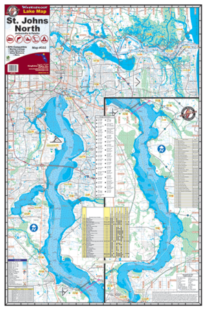
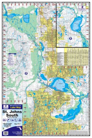
The Kingfisher Maps Waterproof Lake Map St. Johns Central is one of three (3) maps covering the St. Johns River produced by Kingfisher Maps. The St. Johns Central map includes coverage from Palatka to Astor, FL with detailed information on Lake George & Crescent Lake. This 24″ x 36″, one-sided fishing and boating map comes folded down to 6″ x 9″. It is printed on a durable, waterproof, tear-resistant paper and includes marinas, campgrounds, boat ramps, depths and buoys.
Additional information
| Weight | N/A |
|---|