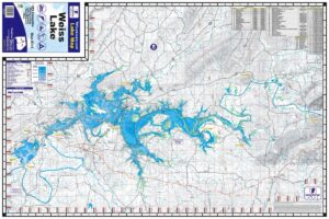
Lake James Waterproof Map #1214
$13.99 – $34.99


Lake James Waterproof Map #1214
$13.99 – $34.99
- Waterproof & Tear Resistant Lake Map
- 24″ x 36″, Folds to 6″ x 9″
- One-sided Topographical Map
- Detailed Depth Information
- Boat Ramps, Campgrounds & Marinas
- GPS Locations for Hazard Buoys & Fish Attractors
- Lake James State Park Trails
- Full Color
The Kingfisher Maps Lake James Waterproof Map includes detailed coverage of Lake James located in North Carolina on the upper portion of the Catawba River. This 24″ x 36″, one-sided, topographical lake map includes marinas, campgrounds, recreation areas, boat ramps, contour intervals, and more. The map is printed on a durable, waterproof, tear-resistant paper and folds down to 6″ x 9″.