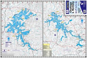
Blue Ridge & Burton Lakes Waterproof Map #319
Price range: $13.99 through $34.99


Blue Ridge & Burton Lakes Waterproof Map #319
Price range: $13.99 through $34.99
- Waterproof & Tear-Resistant Map
- 50ft Contour Lines for Blue Ridge Lake
- No Contour Lines for Lake Burton
- Boat Ramps, Marinas & Campgrounds
- Local Points of Interest
- Full Color
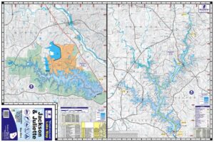
The Kingfisher Maps Waterproof Fishing Map Blue Ridge & Burton includes detailed coverage of both Blue Ridge & Burton Lakes located in the North Georgia Mountains. The map also includes coverage of Seed & Rabun Lake. This 24″ x 36″, one-sided, topographical lake map includes marina listings, campgrounds, boat ramps, points of interest, creek channels and more. The map is printed on a durable, waterproof, tear-resistant paper and folds down to 6″ x 9″.
The Lake Burton coverage is vicinity only. No Contour Intervals are available for Lake Burton.